Waseca County, Minnesota Property Appraiser Search Latest Records 2026
In Waseca County, Minnesota, there are 12,235 parcels. Search property records by parcel number, owner name, or property address. Enter Parcel ID with spaces with dash (example: 27001-11-1-124900) to view ownership, tax, and property details.
Minnesota Property Search
Search the public Minnesota parcel API by parcel number, owner name, or property address.
The Waseca County, Minnesota Appraiser’s office maintains accurate parcel data for public use. The county tracks 12,235 parcels and 23,847 matched buildings using aerial imagery and property information. Updates include 11,109 secondary addresses, while 11,372 parcels have standardized zoning, supporting reliable property assessments and tax roll accuracy.
Waseca County, Minnesota Property Overview – 2026
Waseca County includes 7,200 residential properties and 523 commercial properties. The average single-family home is 59 years old with 1,230 sq. ft. In 2026, there were 29 residential sales, 0.21% homes seriously underwater, and an effective property tax of 1.06%.
Residential Properties
7,200
Commercial Properties
Avg. Home Age Single Family
Avg. Square Feet Single Family
Residential Sales 2026
Homes Seriously Underwater
Residential Sales past year
Rich Homes percentage
Effective 2026 Property Tax
Total Foreclosure Filings 2025
3
Explore Surrounding Counties of Waseca County
Discover counties located around Waseca County to find useful regional information such as property records, GIS maps, court services, and other local administrative resources. This section helps strengthen internal linking while allowing users to quickly navigate nearby areas for tax information, public records, and essential county-level services, improving both usability and SEO structure.
3 Main Cities in Waseca County, Minnesota
Major cities in Waseca County, Minnesota include Waseca city, Janesville, and New Richland. These areas serve as primary residential and commercial centers, with historic neighborhoods, modern developments, and active communities contributing to parcel tracking and property assessments.
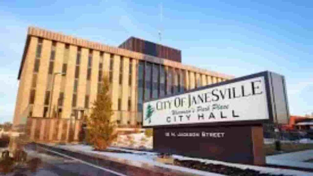
Janesville
1,747 Parcels
Waseca City
4,753 parcels
1,314 Parcels
4 Methods Waseca County, Minnesota Property Search Tool 2026
The Waseca County, Minnesota Property Search Tool provides free online access to property information. Search by owner name, parcel number (PIN), property address, or city to quickly view ownership, tax, sales, and detailed property records.
Search By Owner Name
Lookup properties in Waseca County, Minnesota by owner name for ownership verification.
Search By Address
Enter a full property address in Waseca County, Minnesota to find parcel records.
Search By Parcel PIN
Use the parcel number for precise property searches in Waseca County, Minnesota.
Search By City Name
If other info is unavailable, search by city name to access property details in Waseca County, Minnesota.
Waseca County, Minnesota Property Search Information
The Waseca County, Minnesota Property Search Tool provides detailed property information with each search. Access ownership, tax, land, and assessment data using owner name, parcel number, or property address.
Parcel Number
The parcel number uniquely identifies properties in Waseca County, Minnesota. It allows users to quickly find ownership details, property records, and tax information using the official search tool.
Owner Name
The owner name section lists the registered property owner in Waseca County, Minnesota, allowing verification of legal ownership and identification of the parcel holder.
Full Site Address
The full site address provides the complete property location in Waseca County, Minnesota, including street details for precise identification of parcel boundaries.
Site Address City
The site address city indicates the city or municipality for properties in Waseca County, Minnesota, helping users understand regional location and local governance.
Mailing Address
The mailing address shows where official property-related correspondence, tax notices, and bills are sent in Waseca County, Minnesota, sometimes differing from the property’s physical site.
Site Address Zip
The site address ZIP indicates the postal area for properties in Waseca County, Minnesota, assisting with accurate searches, correspondence, and official record verification.
Land Value
Land value represents the assessed worth of land alone in Waseca County, Minnesota, excluding buildings or improvements, helping estimate the base property value.
Improved Value
The improved value reflects the total value of buildings or structures on a property in Waseca County, Minnesota, calculated separately from raw land assessment.
Parcel Vaule
The parcel value combines land and improved values to give total assessed property value in Waseca County, Minnesota, used for taxation purposes.
GIS Arces
GIS acres show the exact land area of a property in Waseca County, Minnesota, determined using geographic information system mapping for accurate measurements.
Structure Year
The structure year identifies when the main building on a property in Waseca County, Minnesota was built, helping assess building age and potential condition.
Last Sale Date
The last sale date displays the most recent transaction for a property in Waseca County, Minnesota, providing ownership history and market activity insights.
Tax Parcel Use Code Description
This section explains property classification in Waseca County, Minnesota for taxation purposes, such as residential, commercial, or agricultural, helping users understand official parcel categorization.
Full Legal Description
The full legal description provides official wording describing property boundaries in Waseca County, Minnesota, ensuring accurate legal and tax documentation.
County Name
The county name confirms that a property belongs to Waseca County, Minnesota, verifying the responsible jurisdiction for property and tax data.
Waseca County, MN Property Tax & Community Data
Community-level property and tax data across Waseca County, Minnesota, including estimated parcels, population, land area, preliminary millage rates, and median property tax bills to provide insight into local taxation and real estate distribution.
| City / Community Name | Total Parcels (Est.) | Total Population (2026) | Area (Sq Mi) | Preliminary Millage Rate (2026) | Median Tax Bill (Est.) |
|---|---|---|---|---|---|
| Waseca City (Seat) | 4,753 | 9,150 | 4.3 | ~52.5% – 55.8% | $1,850 – $2,300 |
| Janesville | 1,747 | 2,345 | 1.8 | ~49.2% – 52.4% | $1,600 – $2,050 |
| New Richland | 1,314 | 1,215 | 0.6 | ~48.1% – 51.5% | $1,250 – $1,650 |
| Waldorf | 480+ | 215 | 0.4 | ~45.5% – 48.9% | $950 – $1,300 |
FAQs
How can I perform a Waseca County property search to find parcel and ownership details?
You can use online property search tools and GIS-based systems to access parcel information, ownership records, property values, and tax details for properties within Waseca County, Minnesota.
Where can I check the Waseca County Jail roster for inmate information?
The Waseca County Jail roster is available through official county resources and provides inmate listings, booking details, and custody status for individuals held in the county jail.
How do I access Waseca County Court records and Court Calendar?
You can view Waseca County Court records for case filings, hearing outcomes, and legal documents. The Waseca County Court Calendar helps you track scheduled hearings, trial dates, and upcoming court proceedings.
What services are offered by Waseca County GIS and Social Services?
The Waseca County GIS system provides interactive maps, land parcels, and geographic data for planning and research. Waseca County Social Services offers support programs such as family assistance, health-related services, and community welfare programs within Waseca County, Minnesota.
What is Waseca, Minnesota and what does “Waseca County Minnesota FS25” refer to?
Waseca, Minnesota is a city located within Waseca County and serves as a local hub for government services and community activities. The term “Waseca County Minnesota FS25” may refer to internal file systems, dataset references, or shorthand used in specific platforms related to county records or data categorization.